

Viac o knihe
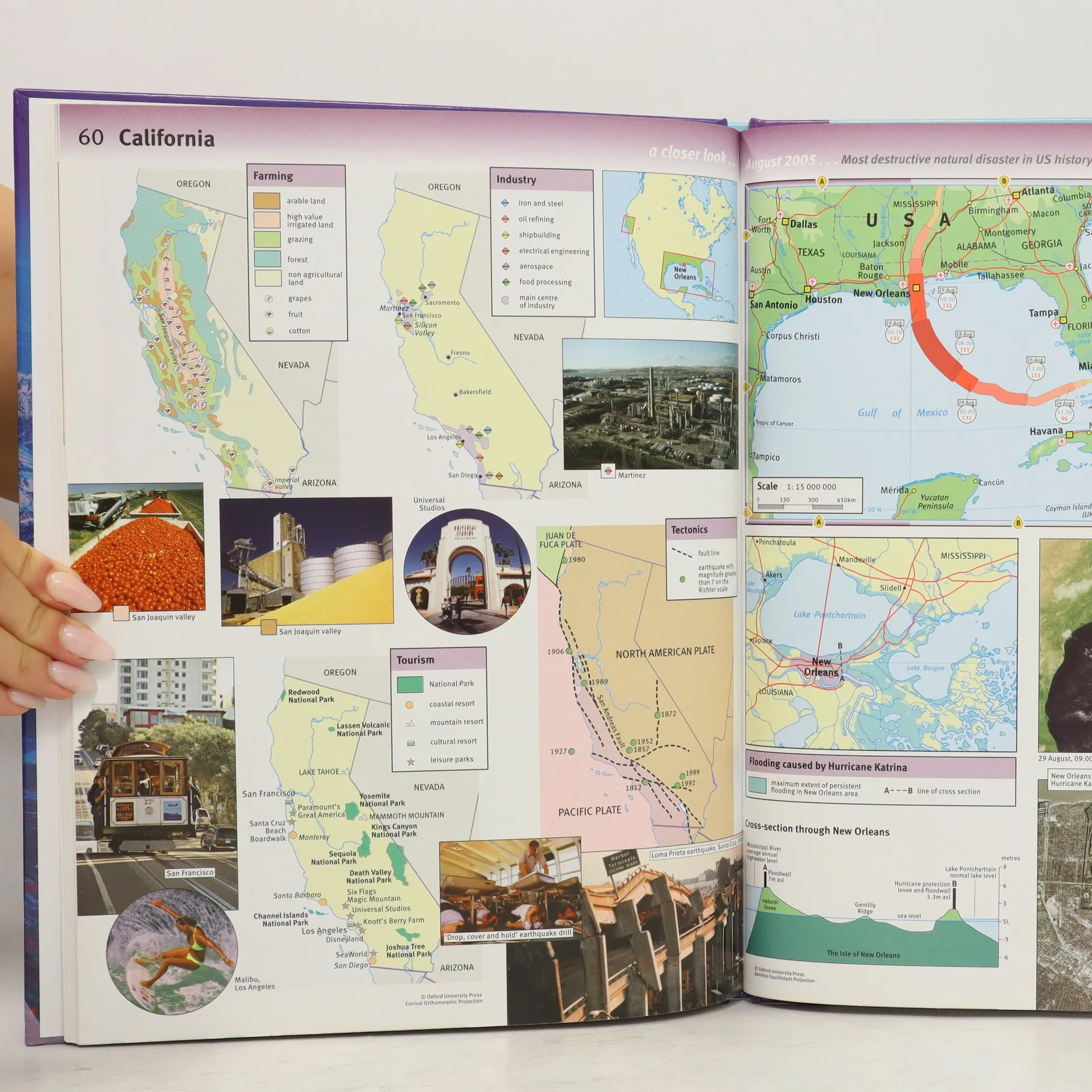
The Oxford School Atlas is a completely new, up-to-date atlas with digital maps that are accurate and easy-to-read. Satellite images, photographs and artwork are used to enhance the themes chosen in the atlas. The mapping is very clear, the level of detail accessible to all 10+ geographers andthe topics specifically chosen to cover the key curriculum requirements. Easy-to-use features include a multi-access contents page, clear explanations of graphics, country data files, a two-colour index of place names, and flags of the world at a usable size. There is comprehensive coverage of theBritish Isles, together with continental and world mapping and a world statistical section. It includes case studies on topics that will appeal to children such as earthquakes and volcanoes, flooding and tsunamis, hurricanes and weather patterns, economy and tourism as well as specific countrystudies on Italy, Kenya, Brazil, Japan, and Antarctica.
Nákup knihy
Oxford School Atlas, Dr Patrick Wiegand
- Jazyk

- Rok vydania
- 2006
- product-detail.submit-box.info.binding
- (pevná)
Platobné metódy
Nikto zatiaľ neohodnotil.
- Titul
- Oxford School Atlas
- Jazyk
- anglicky
- Autori
- Dr Patrick Wiegand
- Vydavateľ
- Oxford University Press
- Rok vydania
- 2006
- Väzba
- pevná
- Počet strán
- 96
- ISBN10
- 019832569X
- ISBN13
- 9780198325697
- Série
- Štítky
- Náučná literatúra, Encyklopédie
- Anotácia
- The Oxford School Atlas is a completely new, up-to-date atlas with digital maps that are accurate and easy-to-read. Satellite images, photographs and artwork are used to enhance the themes chosen in the atlas. The mapping is very clear, the level of detail accessible to all 10+ geographers andthe topics specifically chosen to cover the key curriculum requirements. Easy-to-use features include a multi-access contents page, clear explanations of graphics, country data files, a two-colour index of place names, and flags of the world at a usable size. There is comprehensive coverage of theBritish Isles, together with continental and world mapping and a world statistical section. It includes case studies on topics that will appeal to children such as earthquakes and volcanoes, flooding and tsunamis, hurricanes and weather patterns, economy and tourism as well as specific countrystudies on Italy, Kenya, Brazil, Japan, and Antarctica.