
Presne táto pôjde do košíka
Parametre
- 147 stránok
- 6 hodin čítania
Viac o knihe
The study delves into the topography and landscape of Roman Dacia, exploring its road network and geographical perceptions before and after the Roman conquest. It analyzes ancient sources, including the 'Tabula Peutingeriana' and archaeological remains, to reconstruct the main roads. The author also investigates rural settlements like Potaissa and Napoca, along with Roman bridges. By integrating historical cartography and modern digital data, the work offers a comprehensive recreation of the landscape of Roman Dacia, highlighting its historical significance.
Nákup knihy
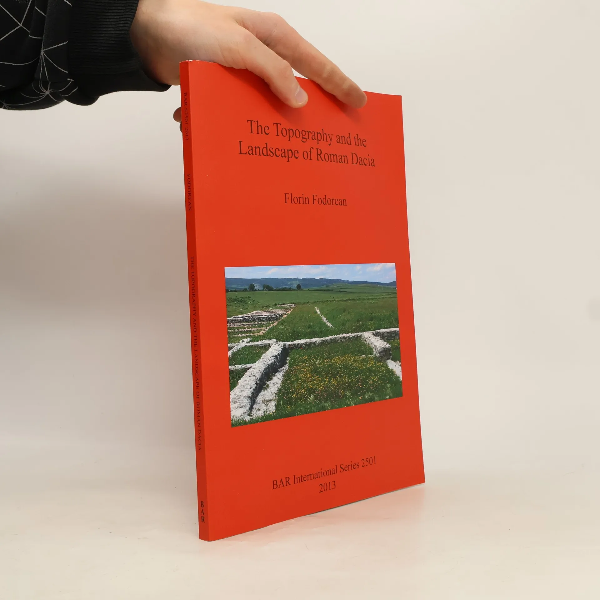
The Topography and the Landscape of Roman Dacia, Florin-Gheorghe Fodorean
- Jazyk

- Rok vydania
- 2013
- product-detail.submit-box.info.binding
- (mäkká),
- Stav knihy
- Veľmi dobrá
- Cena
- 29,99 €
Platobné metódy
Nikto zatiaľ neohodnotil.
- Titul
- The Topography and the Landscape of Roman Dacia
- Jazyk
- anglicky
- Autori
- Florin-Gheorghe Fodorean
- Rok vydania
- 2013
- Väzba
- mäkká
- Počet strán
- 147
- ISBN10
- 1407311174
- ISBN13
- 9781407311173
- Série
- Štítky
- Náučná literatúra, Spoločenské vedy, Historické téma, Svetová história, Archeológia, Staroveký Rím, Svätá ríša rímska, Krajinná archeológia
- Anotácia
- The study delves into the topography and landscape of Roman Dacia, exploring its road network and geographical perceptions before and after the Roman conquest. It analyzes ancient sources, including the 'Tabula Peutingeriana' and archaeological remains, to reconstruct the main roads. The author also investigates rural settlements like Potaissa and Napoca, along with Roman bridges. By integrating historical cartography and modern digital data, the work offers a comprehensive recreation of the landscape of Roman Dacia, highlighting its historical significance.